

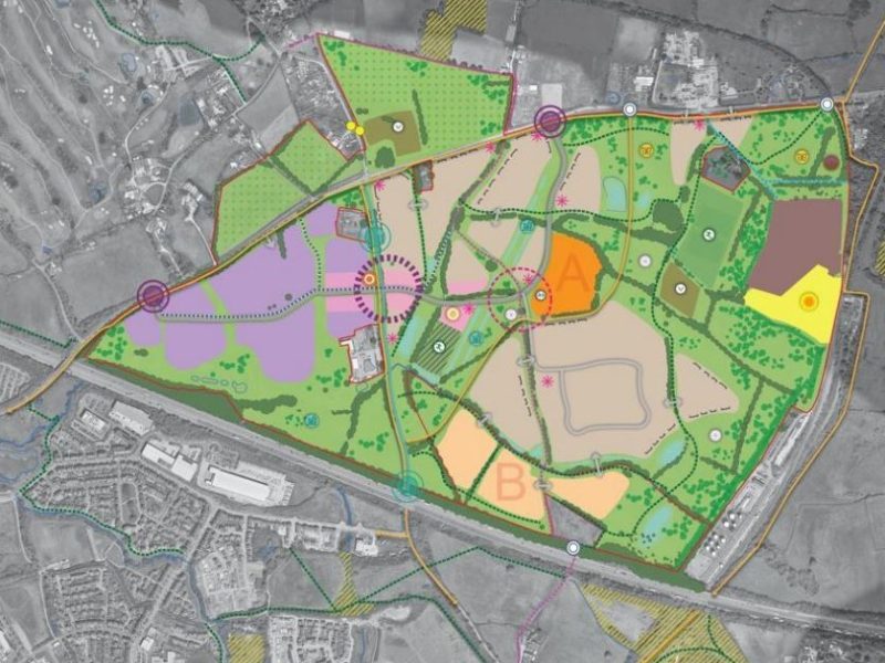
DEVELOPERS have started the process of getting planning permission for more than 2,000 new homes next to Lyde Green.
Land North of Lyde Green JV LLP, the joint venture between Places for People, BraceyCo Limited and the owners of land, has asked South Gloucestershire Council to provide a statement, known as a ‘scoping opinion’, on the factors they need to include in an environmental impact assessment for the site. It is the first step towards a full planning application for the site on the opposite side of the M4 to Lyde Green, which has been earmarked for 2,050 homes and employment land to extend the nearby Bristol & Bath Science Park.
The developers have been warned that part of the site is a “Development High Risk Area” due to the presence of old coal mine workings.
Places for People announced last year that it had secured use of the land for a development currently known as the North Lyde Ecotech Village, subject to future planning permission.
It was highlighted as a potential development site in South Glos Council’s draft Local Plan, which is with the government awaiting approval following a public examination over the summer.
As well as homes and a large area for business use, the Local Plan indicated that a local centre and community buildings including a nursery, primary school and/or surgery would be built.
The area is bordered by the M4, Westerleigh Road and the railway line serving the Westerleigh fuel depot. Much of it is farmland but it also includes the Windmill Leisure Golf and Activity Centre, Windmill Fishery and South Gloucestershire Showground.
The site is next to the Pilgrims Europe abattoir, which is the subject of a controversial planning application to expand its operations.
The council has invited responses from the Environment Agency, Coal Authority, NHS, Bristol Water, Natural England and several of its own departments over the proposals. But comments are not being accepted from members of the public during this consultation.
The developer has produced its own risk assessment for the site, which has identified three old mine shafts and evidence of shallow mining activity, along with assessing waterways and flood risk.
In its response to the council, the Coal Authority, which manages the environment in mining areas, said there were three mine shaft entrances in the area, which is close to the former Parkfield Colliery.
The authority said: “The risk these features may pose should be considered as part of the planning process.
“More specifically, our records indicate that coal mining has taken place beneath the site, including at shallow depth, with underground mine roadways also present, including at shallow depth.
“In addition, the site lies in an area where further historic unrecorded shallow coal mining activity is likely to have taken place.
“Voids and broken ground associated with such workings can pose a risk to ground stability and public safety.”
The NHS Bristol, North Somerset and South Gloucestershire Integrated Care Board, which funds health service provision in the area, says the developers should pay just over £809,000 towards expanding GP practices in the area, adding that otherwise there would be unsustainable pressure on local primary healthcare infrastructure.
Under the draft Local Plan, between 1,050 and 1,350 homes would be built before 2041 and the rest afterwards, with buildings up to six storeys tall.
Places for People has said it intends more than 30% of them to be classed as ‘affordable’, for social rent or shared ownership schemes.
The application can be viewed by searching for reference number P26/011/SCO on the council’s planning website.